


The National Weather Service has issued a STRONG THUNDERSTORM WILL IMPACT MARSHALL COUNTY at about 5:15 PM.
At 427 PM EDT/327 PM CDT/, Doppler radar was tracking a strong
thunderstorm near Ora, or 9 miles northeast of Winamac, moving
northeast at 30 mph.
HAZARD...Wind gusts up to 50 mph and half inch hail.
SOURCE...Radar indicated.
IMPACT...Gusty winds could knock down tree limbs and blow around unsecured objects. Minor hail damage to vegetation is possible.
Locations impacted include...
Plymouth, Bremen, Knox, Bourbon, Argos, Culver, Walnut, Tippecanoe,
Oak Grove, Monterey, Leiters Ford, Ober, Twin Lakes, Inwood, Rutland,
Burr Oak, Maxinkuckee, Hibbard, Winona, and Delong.
PRECAUTIONARY/PREPAREDNESS ACTIONS...
If outdoors, consider seeking shelter inside a building.
 Indiana AG warns of human trafficking during Final Four
 Police find man hiding in attic
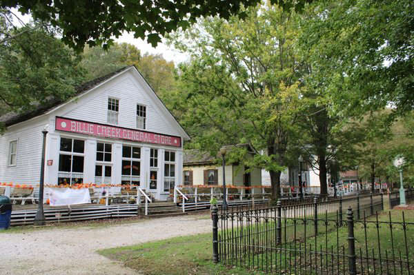 Billie Creek Village ready for another season
 Voter registration deadline April 6
 Flags ordered to half-staff for Captain Seth Koval
 Conrady seeks Rockville Town Board seat
 Peebles looks to keep Vermillion County Commissioner seat
 Indiana launches enforcement campaign to target distracted driving and speeding
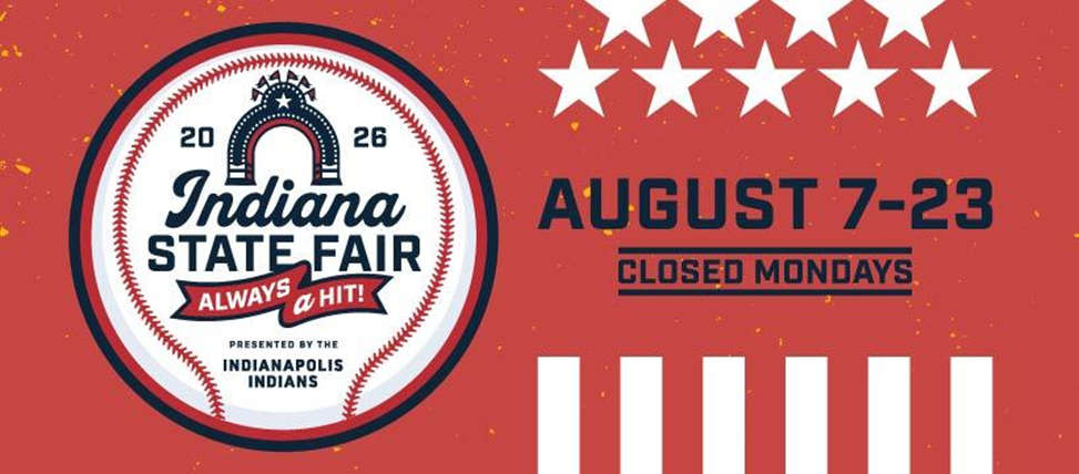 Indianapolis Indians named title partner of the 2026 Indiana State Fair
 Carlisle man leads Parke County officers, others on chase
 Game audio: 2A State Championship, Parke Heritage 57, Westview 56 (Air date March 28, 2026)
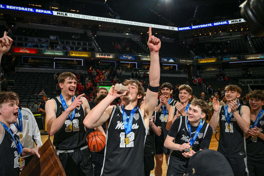 Parke Heritage captures first ever state championship
 New Space Force license plate design
 Indiana announces launch of enhanced system for Hoosier military and overseas voters
 Wolves look to take final step in 2A title game