


The National Weather Service has issued a STRONG THUNDERSTORM WILL IMPACT MARSHALL COUNTY at about 5:15 PM.
At 427 PM EDT/327 PM CDT/, Doppler radar was tracking a strong
thunderstorm near Ora, or 9 miles northeast of Winamac, moving
northeast at 30 mph.
HAZARD...Wind gusts up to 50 mph and half inch hail.
SOURCE...Radar indicated.
IMPACT...Gusty winds could knock down tree limbs and blow around unsecured objects. Minor hail damage to vegetation is possible.
Locations impacted include...
Plymouth, Bremen, Knox, Bourbon, Argos, Culver, Walnut, Tippecanoe,
Oak Grove, Monterey, Leiters Ford, Ober, Twin Lakes, Inwood, Rutland,
Burr Oak, Maxinkuckee, Hibbard, Winona, and Delong.
PRECAUTIONARY/PREPAREDNESS ACTIONS...
If outdoors, consider seeking shelter inside a building.
 Indiana AG warns of human trafficking during Final Four
 Authorities looking for missing Owen County female
 Application period now open for POET Bioprocessing – Cloverdale Community Impact Grants
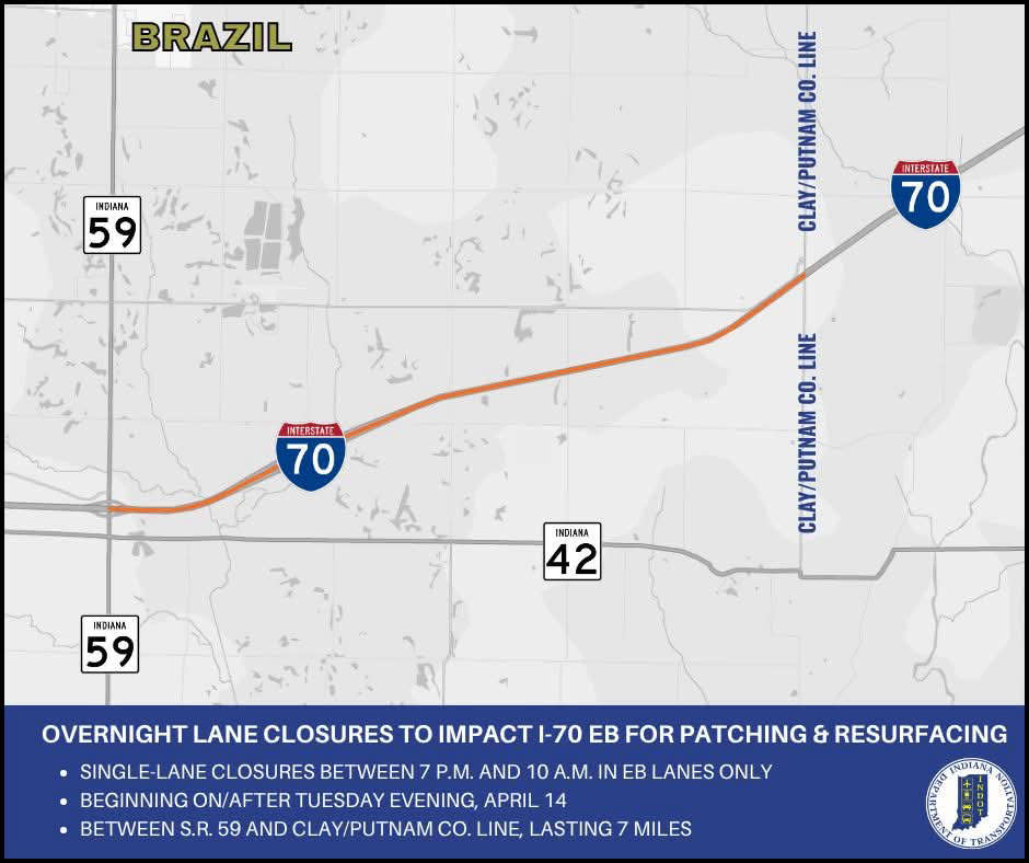 Overnight lane closures to impact I-70 eastbound in Clay County
 Crabgrass Control
 Putnamville Correctional Facility employee accused of smuggling drugs
 Franciscan Physician Network Sports Medicine, Putnam County Hospital announce collaboration for advanced sports medicine