

A strong and severe storm system rolled through Lawrence, Knox and other surrounding counties Wednesday evening and night.
It spawned numerous tornado and thunderstorm watches and warnings and downed trees and power lines with other widespread damage.
There were no initial reports of serious injuries.
Damage assessments are currently underway.
The National Weather Service (NWS) is continuing the Flood Watch for the region through Sunday, April 6th.
Additional rainfall in excess of 4 inches is likely through the period for multiple rounds of showers and thunderstorms.
Excessive runoff could result in the flooding of local and area rivers, creeks and streams.
Those residing in areas prone to flooding should monitor the latest weather conditions and be prepared to take action should flooding occur.
 Greenfield Police Department attempt to locate juvenile runaway
 Sting operation nets handful of arrests involving online child sex offenders
 Indiana law enforcement to increase impaired driving enforcement ahead of Labor Day
 SHS announces newest members of Alumni Hall of Fame
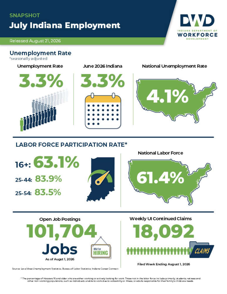 Indiana July unemployment rate below national average
 Milestone season on tap for Shelbyville football
 Indiana State Fair "Taste of the Fair" presented by Pepsi announces 2026 winners