A strong and severe storm system rolled through Lawrence, Knox and other surrounding counties Wednesday evening and night.
It spawned numerous tornado and thunderstorm watches and warnings and downed trees and power lines with other widespread damage.
There were no initial reports of serious injuries.
Damage assessments are currently underway.
The National Weather Service (NWS) is continuing the Flood Watch for the region through Sunday, April 6th.
Additional rainfall in excess of 4 inches is likely through the period for multiple rounds of showers and thunderstorms.
Excessive runoff could result in the flooding of local and area rivers, creeks and streams.
Those residing in areas prone to flooding should monitor the latest weather conditions and be prepared to take action should flooding occur.
 Indiana wrapping up recounts in three legislative races
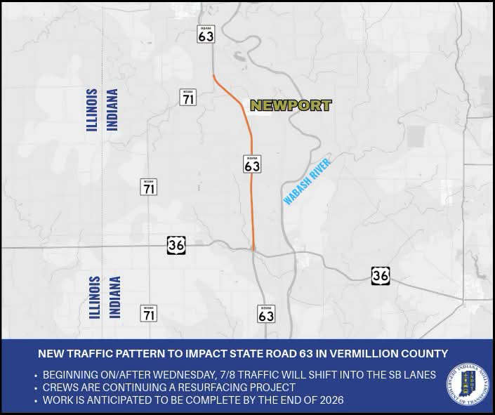 New traffic pattern to impact State Road 63 in Vermillion County
 Illinois man arrested after chase through Vermillion, Parke counties
 Garth Brooks announces The Blame It All On My Roots Tour kicking off at Gainbridge Fieldhouse
 Art and photo contest open for DNR hard card licenses
 IFB: Summer cookout costs decrease for Indiana shoppers, lower than U.S. average
 $22 million Fourth of July water roller coaster coming to Holiday World & Splashin’ Safari
 ISDA Launches IMAGE Cost-Share Program for southwest Indiana producers
 July 4th: Red Cross offers safety tips for a harmless holiday
 Full steam ahead: Indiana State Fair to debut new Family Train Ride in 2026
 Governor Braun highlights America 250 Celebrations, encourages communities to participate with sSpecial grant program
 Arts grant to support Parke Players’ summer musical, Ritz Theater
 Missing teen Peyton Fulk found in Florida
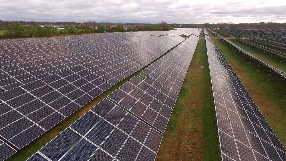 Vermillion County Commissioners ready to look at solar overhaul
 Know your fireworks laws, safety this holiday season
 Two Parke County road closures today