

News
The National Weather Service has issued a STRONG THUNDERSTORM WILL IMPACT MARSHALL COUNTY
at about 5:15 PM.
At 427 PM EDT/327 PM CDT/, Doppler radar was tracking a strong
thunderstorm near Ora, or 9 miles northeast of Winamac, moving
northeast at 30 mph.
HAZARD...Wind gusts up to 50 mph and half inch hail.
SOURCE...Radar indicated.
IMPACT...Gusty winds could knock down tree limbs and blow around
unsecured objects. Minor hail damage to vegetation is
possible.
Locations impacted include...
Plymouth, Bremen, Knox, Bourbon, Argos, Culver, Walnut, Tippecanoe,
Oak Grove, Monterey, Leiters Ford, Ober, Twin Lakes, Inwood, Rutland,
Burr Oak, Maxinkuckee, Hibbard, Winona, and Delong.
PRECAUTIONARY/PREPAREDNESS ACTIONS...
If outdoors, consider seeking shelter inside a building.
 Plan Ahead: Your guide to getting to the 2026 Indiana State Fair safely and smoothly
 Aug. 2-8 is Emergency Management Agency Appreciation Week
 New Office of Cybersecurity established in Indiana
 Kratos completes $50 million state-of-the-art hypersonic systems payload integration facility in Indiana
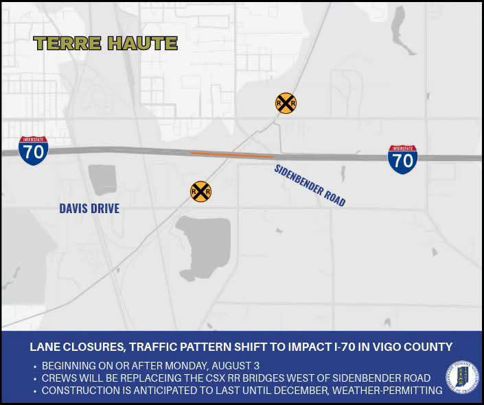 Lane closures, traffic pattern shift to impact I-70 in both directions in Vigo County
 Lilly Endowment Scholarship available thru PCCF on Saturday
 Take a ride in aviation history in Terre Haute this weekend