


The Illinois State Water Survey is partnering with the Federal Emergency Management Agency (FEMA) to examine the flood risk along five creeks in Lawrence County.
They are Brushy Creek, Muddy Creek, Shirley Creek, Indian Creek and the Indian Creek tributary.
Survey crews will be operating along those creeks beginning this month of May and continuing throughout the summer. The surveyors will be getting channel and bridge measurements along with topographic elevations and photographs within and around the creek banks to be used in computer models estimating the potential flooding threat.
The study will also be used to improve and update the Flood Insurance Rate Maps (FIRM) for Lawrence County. No property disruptions are anticipated.
 Governor Braun proclaims Indiana Rail Safety Week September 21-27
 Central Indiana housing inventory continues to grow as home prices hold steady
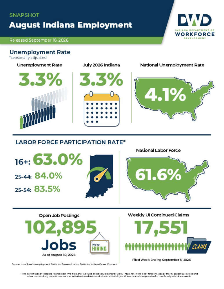 State unemployment rate remains below national average
 Indiana weekly gas price update
 McCordsville woman sentenced as part of nationwide fraud enforcement
 Decatur County among FSA offices hiring program analyst
 USDA announces 2026 and 2027 enrollment for key price and revenue safety net programs, first base acre increase in two decades
 SCS Superintendent schedules another community meeting in late September