

News
The National Weather Service has issued a STRONG THUNDERSTORM WILL IMPACT MARSHALL COUNTY
at about 5:15 PM.
At 427 PM EDT/327 PM CDT/, Doppler radar was tracking a strong
thunderstorm near Ora, or 9 miles northeast of Winamac, moving
northeast at 30 mph.
HAZARD...Wind gusts up to 50 mph and half inch hail.
SOURCE...Radar indicated.
IMPACT...Gusty winds could knock down tree limbs and blow around
unsecured objects. Minor hail damage to vegetation is
possible.
Locations impacted include...
Plymouth, Bremen, Knox, Bourbon, Argos, Culver, Walnut, Tippecanoe,
Oak Grove, Monterey, Leiters Ford, Ober, Twin Lakes, Inwood, Rutland,
Burr Oak, Maxinkuckee, Hibbard, Winona, and Delong.
PRECAUTIONARY/PREPAREDNESS ACTIONS...
If outdoors, consider seeking shelter inside a building.
 Federal judge blocks Indiana’s ban on use of student IDs for voting
 Indiana releases update to the State Nutrient Reduction Strategy
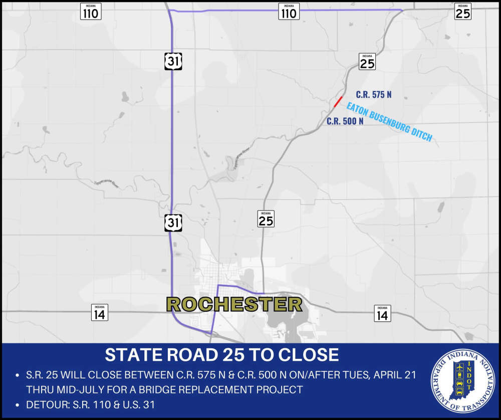 Road closure for State Road 25 in Fulton County
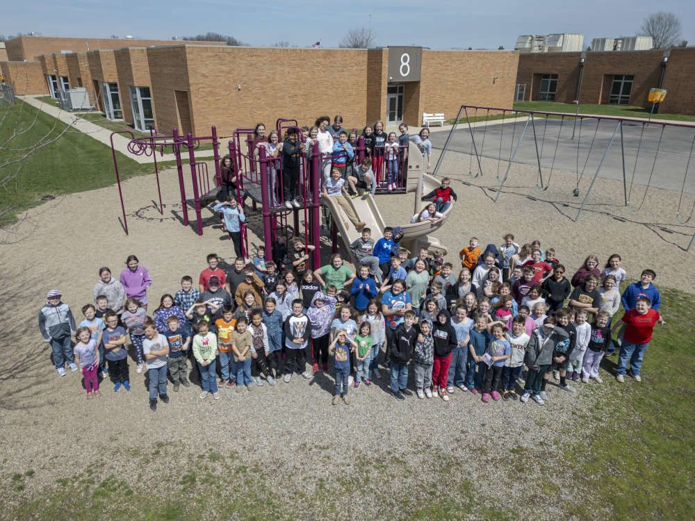 Community leaders unite to bring inclusive playgrounds to Eastern Pulaski Elementary
 Food sport’s biggest stage will be at Indiana State Fairgrounds & Event Center
 U. S. Rep. Rudy Yakym hosting mobile office hours