


The Illinois State Water Survey is partnering with the Federal Emergency Management Agency (FEMA) to examine the flood risk along five creeks in Lawrence County.
They are Brushy Creek, Muddy Creek, Shirley Creek, Indian Creek and the Indian Creek tributary.
Survey crews will be operating along those creeks beginning this month of May and continuing throughout the summer. The surveyors will be getting channel and bridge measurements along with topographic elevations and photographs within and around the creek banks to be used in computer models estimating the potential flooding threat.
The study will also be used to improve and update the Flood Insurance Rate Maps (FIRM) for Lawrence County. No property disruptions are anticipated.
 Fire vs Police on the hardwood for good cause Friday night
 Indiana AG warns of human trafficking during Final Four
 Authorities looking for missing Owen County female
 Application period now open for POET Bioprocessing – Cloverdale Community Impact Grants
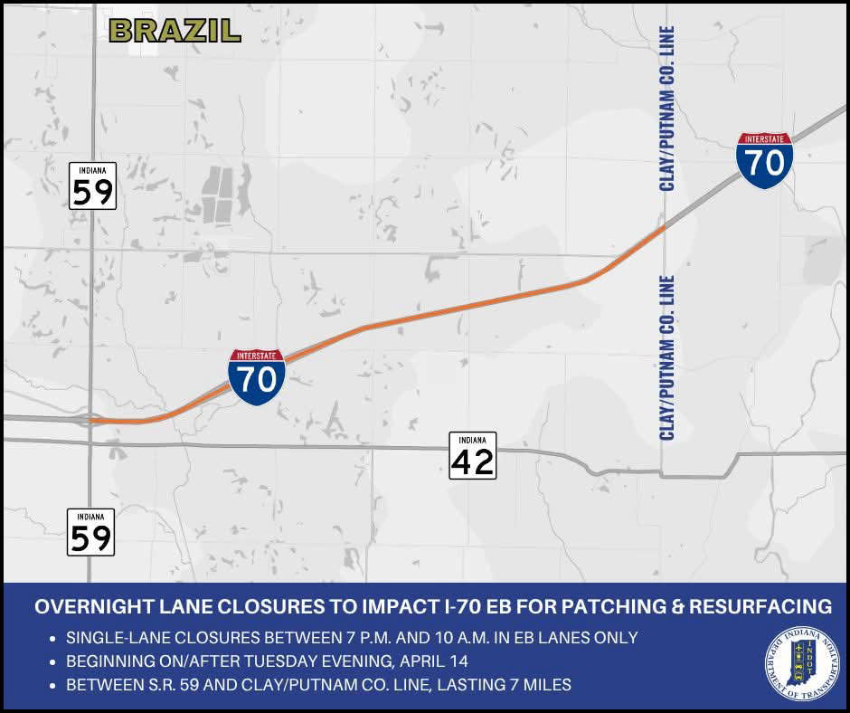 Overnight lane closures to impact I-70 eastbound in Clay County
 Crabgrass Control
 Putnamville Correctional Facility employee accused of smuggling drugs